


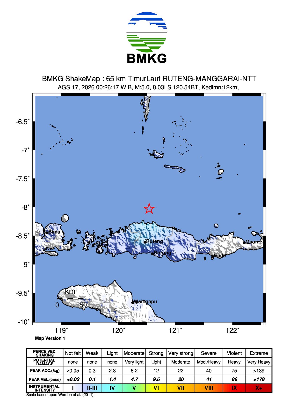
Gempa Bumi M5,0 – 77 km BaratLaut MANGGARAITIMUR-NTT: Penjelasan Mendalam
Gempa Bumi M5,0 – 77 km BaratLaut MANGGARAITIMUR-NTT: Analisis Cuaca dan Geofisika

The current weather conditions in Indonesia are still characterized by the typical dynamics of the transition period. The decrease in cloud cover in the morning to afternoon in several regions has led to more intense surface heating, resulting in hotter air temperatures during the day.
In the period from May 14-17, 2026, maximum temperatures above 35.0°C to 36.0°C were still observed in several regions, including North Sumatra, Lampung, Banten, Central Java, East Java, West Java, East Nusa Tenggara, Southeast Sulawesi, East Kalimantan, and West Papua.
The hot temperatures during the day can support the formation of rain clouds, especially in the afternoon to evening. This opportunity is generally more likely to occur in areas with sufficient air humidity, as the atmospheric conditions support the growth of convective clouds.
This is confirmed by the continued presence of heavy to extreme rainfall in several areas during the same period. The BMKG recorded significant daily rainfall in West Java (184.5 mm/day), Central Kalimantan (129.8 mm/day), West Kalimantan (105.0 mm/day), Riau (95.5 mm/day), South Sulawesi (96.7 mm/day), North Sumatra (91.0 mm/day), North Maluku (87.3 mm/day), Central Sulawesi (78.9 mm/day), Riau Islands (77.6 mm/day), East Nusa Tenggara (61.9 mm/day), and North Kalimantan (53.5 mm/day).
The increase in rainfall potential during this period is influenced by the combination of several active atmospheric dynamics, including the Madden-Julian Oscillation (MJO), Equatorial Rossby Waves, Kelvin Waves, and Mixed Rossby-Gravity (MRG) waves. These phenomena contribute to the growth of rain clouds in some parts of Indonesia.
In the next week, the atmospheric conditions in Indonesia are expected to be influenced by the ongoing El Niño condition, with the SOI value at -7.4 and the NINO 3.4 index at +0.52. Although this indicates a potential decrease in rainfall activity in the eastern part of the country, the MJO phenomenon is still expected to support the growth of convective clouds in several regions.
During this period, the atmospheric conditions will be influenced by various tropical wave activities, including the Kelvin Wave and Equatorial Rossby Wave. These waves can help increase the supply of water vapor and support the formation of rain clouds in the areas they pass through.
Furthermore, the cyclonic circulation expected to form in several areas, such as the Indian Ocean west of North Sumatra, the Java Sea, and the Pacific Ocean northeast of North Maluku, will influence the wind patterns in the surrounding areas. This can create convergence and confluence areas, leading to the growth of convective clouds and increasing the potential for significant rainfall.
Potential Rainfall for the Next Week
The weather in Indonesia is expected to be dominated by light to heavy rainfall. There is a need to be aware of the potential increase in rainfall intensity in several regions, including Aceh, North Sumatra, West Sumatra, Riau, Riau Islands, Jambi, South Sumatra, Bangka Belitung, Bengkulu, Lampung, Banten, Jakarta, Central Java, Yogyakarta, East Java, Bali, West Kalimantan, Central Kalimantan, East Kalimantan, South Kalimantan, Gorontalo, Central Sulawesi, West Sulawesi, South Sulawesi, Southeast Sulawesi, Maluku, West Papua, Papua, and South Papua.
In addition, heavy rainfall accompanied by lightning and strong winds can occur, with categories of early warning and potential areas as follows:
Beware of the potential increase in heavy rainfall in Kepulauan Bangka Belitung, West Java, West Nusa Tenggara, East Nusa Tenggara, North Kalimantan, North Sulawesi, North Maluku, and Papua Mountains.
Considering the ongoing atmospheric dynamics, the BMKG urges the community to be vigilant against the potential for extreme weather, which can lead to hydrometeorological disasters. Drivers should also be cautious of heavy rainfall that may be accompanied by lightning and strong winds, which can disrupt travel.
The BMKG reminds the community to continually monitor weather forecast information, early warnings, and extreme weather warnings through various BMKG information channels, including the website, mobile application, and social media.
The Indonesian Meteorology, Climatology, and Geophysics Agency (BMKG) forecasts the country's rainfall potential for the next week, considering the El Niño condition, MJO phenomenon, and atmospheric waves.
Gempa Bumi M5,0 – 77 km BaratLaut MANGGARAITIMUR-NTT: Analisis Cuaca dan Geofisika
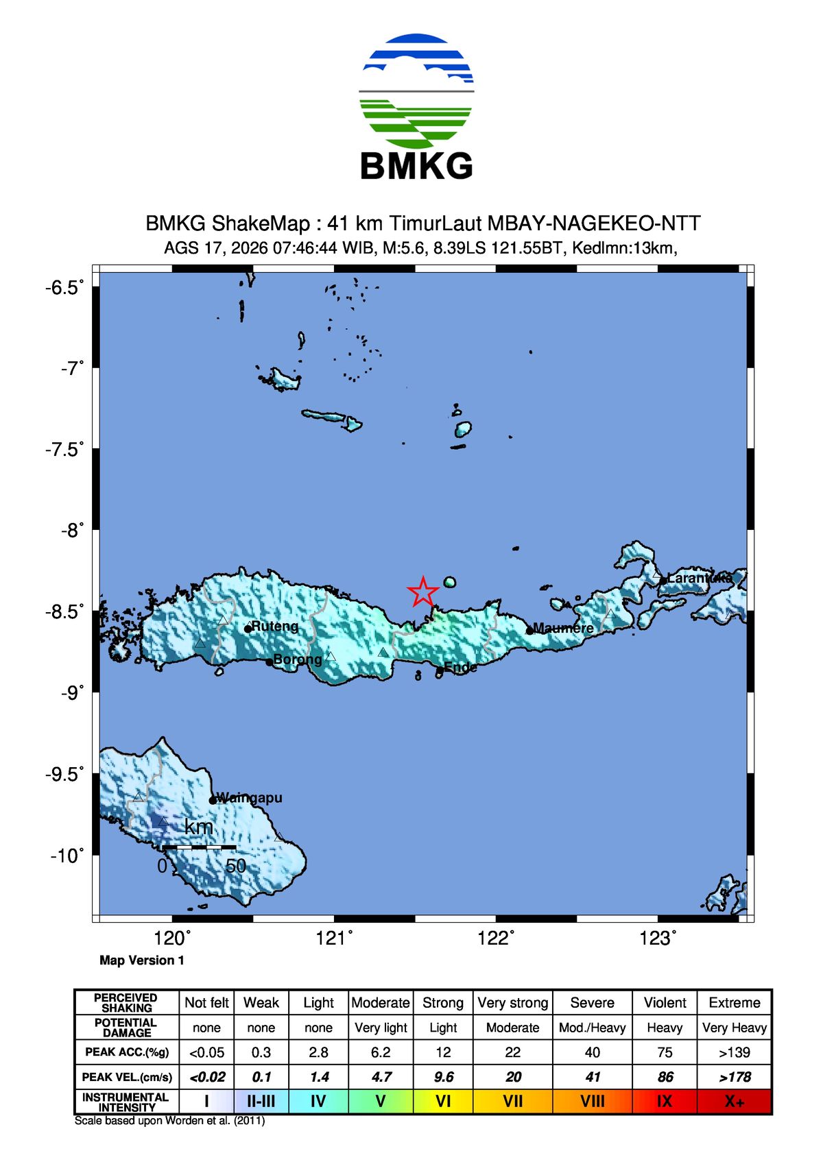
Gempa Bumi M5,8 - 39 km BaratLaut ENDE-NTT, BMKG: Penyebab dan Dampak yang Perlu Diketahui

Gempa M 5,0 Guncang Manggarai NTT, BMKG: Tak Berpotensi Tsunami ANTARA News Kepri
Gempa bumi dengan magnitudo 5,0 mengguncang wilayah Manggarai, Nusa Tenggara Timur (NTT), dan tidak...

Gempa Bumi M5,2 - 83 km TimurLaut MANGGARAITIMUR-NTT BMKG

Gempa kuat terjadi di beberapa wilayah Indonesia, termasuk NTT dan Sumut, dalam satu hari. Badan...

Netizen tidak senang dengan komentar-komentar yang diberikan

BTS mungkin kembali mengikuti Grammy setelah rekanan mereka, Recording Academy, mengumumkan revisi...
BTS mungkin tidak akan mengubah keputusan untuk mengabaikan Grammy karena deadline pengiriman musik...
Update terbaru tentang keputusan BTS untuk tidak mengirimkan musik mereka untuk dijadikan nominee...
Pihak Recording Academy mengumumkan akan kembali meninju keputusan untuk memperkenalkan kategori...

Sangyeop Sangyeop mengumumkan rencananya untuk menikah dengan seorang non-celebrity, mengejutkan...