




Hawaiian Electric Provides Statewide Power Restoration Update
Hawaiian Electric has issued a comprehensive update on the status of power restoration across the...
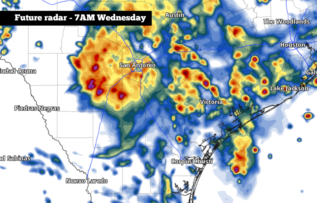
The San Antonio area is bracing for widespread flooding as a potent low-pressure system brings heavy rainfall to South Texas. According to forecasts, up to 15 inches of rain may fall in some areas, with the highest totals expected west of San Antonio. This would be one of the largest rainfall events in the region's history, surpassing the devastating 2017 floods that left many homes and businesses destroyed.
In the past 24 hours, areas to the west have experienced the brunt of the flooding rainfall. Kerrville has recorded 4.6 inches of rain since Monday, causing significant flooding throughout the city. The Hill Country towns of Uvalde and western Medina counties have also seen pockets of 6 to 12 inches of rain, with flash flood warnings in place until Tuesday afternoon. The widespread rainfall has already caused road closures and disruptions in many areas.
The National Weather Service has issued a flood watch for parts of South Texas, which includes the southern Hill Country and Rio Grande Plains. This region is under a rare level 4 'high' risk of excessive rainfall, meaning widespread flash flooding is likely. In this area, widespread rainfall totals between 3 and 6 inches are expected, with isolated higher totals of 10 to 20 inches possible. This could lead to catastrophic flooding, with travel highly discouraged overnight and early Wednesday.
Farther east, San Antonio and the central Hill Country are under a level 3 of 4 risk, which still means a 40% chance of flash flooding within 25 miles of any point. Additional rainfall between 2 and 5 inches is expected, though isolated totals approaching 8 inches are also possible. Residents are advised to stay indoors and avoid travel unless absolutely necessary.
The heaviest rainfall is expected to occur from Tuesday night through Wednesday afternoon, with scattered thunderstorms persisting into the late evening hours. The potential rainfall totals across the region through 6 p.m. Wednesday, according to the HRRR weather model, show isolated totals of up to 20 inches possible in a few spots. The highest chance of flash flooding will occur throughout the early morning hours on Wednesday, some of which has the potential to be damaging and life-threatening.
Residents are advised to seek shelter and not drive over flooded roadways. The Texas Department of Transportation and local emergency management officials have warned of potentially life-threatening situations, especially for those traveling or driving in flood-prone areas. With a saturated ground, even minor rainfall could lead to significant flooding, especially in urban areas.
The region's infrastructure may not be equipped to handle the massive floodwaters, with some areas experiencing severe waterlogging. This could lead to property damage, displacement, and even loss of life. In such cases, local authorities may declare a state of emergency or evacuate affected areas.
Anthony Franze, a native Texan and broadcast meteorologist, noted, 'The heavy rainfall is not an isolated incident. This is part of a larger pattern of extreme weather events that Texas has seen in recent years.' He emphasizes the importance of public preparedness and safety measures during such events.
In the coming days, the region can expect scattered thunderstorms to continue, but with a break in the activity expected in the late afternoon and evening. The flooding will likely subside by Thursday evening, but residents are advised to remain vigilant and cautious throughout the period. Stay with expressnews.com/weather for updates and follow evacuation orders from local authorities.
In conclusion, the upcoming catastrophic flooding event in South Texas underscores the region's vulnerability to extreme weather events. By being aware of the warning signs, taking necessary precautions, and staying updated with local news and weather forecasts, residents can minimize risks and stay safe during this challenging time.
A 500-year flood event may be unfolding west of San Antonio, with areas under a rare level 4 'high' risk of excessive rainfall. Here's a timeline of the impending flooding.
Hawaiian Electric has issued a comprehensive update on the status of power restoration across the...
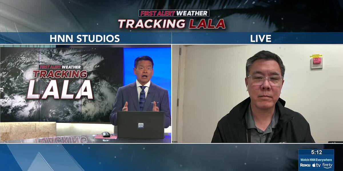
Darren Pai from Hawaiian Electric shares a critical 5 p.m. update on the ongoing power outage...

Stay informed about Tropical Storm Lala's impact on Hawaii, with updates on warnings, advisories,...
A comprehensive overview of the Sorrento Fire, including its impact, key facts, and future...

Kelsey Mitchell Leads the Charge: Fever Secures Thrilling Victory - A Recap and Analysis

A devastating brush fire has been raging in San Diego, necessitating the expertise of local fire...

Netizen tidak senang dengan komentar-komentar yang diberikan

BTS mungkin kembali mengikuti Grammy setelah rekanan mereka, Recording Academy, mengumumkan revisi...
BTS mungkin tidak akan mengubah keputusan untuk mengabaikan Grammy karena deadline pengiriman musik...
Update terbaru tentang keputusan BTS untuk tidak mengirimkan musik mereka untuk dijadikan nominee...
Pihak Recording Academy mengumumkan akan kembali meninju keputusan untuk memperkenalkan kategori...

Sangyeop Sangyeop mengumumkan rencananya untuk menikah dengan seorang non-celebrity, mengejutkan...